Viktor Neumann · 14 September 2026
Tracing Elevation Pattern Shifts in Upland Regions and Their Links to Erosion Cycles
Upland regions across continents display measurable shifts in elevation patterns that connect directly to recurring erosion cycles, and researchers track these changes through repeated surveys that combine satellite data with ground measurements. Elevation patterns refer to the distribution of heights and slopes in areas above typical lowland elevations, while erosion cycles describe the repeated processes of material removal and deposition driven by water, wind, and gravity over decades or centuries. Data from multiple monitoring networks show that these patterns do not remain static, and small annual adjustments accumulate into larger landscape alterations when precipitation intensity or temperature regimes change.
Measurement Techniques Used in Upland Studies
Scientists employ airborne LiDAR systems and interferometric synthetic aperture radar to capture elevation differences at scales of centimeters across broad upland zones, and these tools allow comparison of datasets collected years apart. Ground-based total stations and GPS networks provide validation points that reduce uncertainty in the remote sensing results, while repeated flights over the same transects build time series that reveal both gradual trends and abrupt events. In regions with dense vegetation, researchers adjust for canopy effects by filtering point clouds to isolate bare earth returns, and this step ensures elevation models reflect actual surface movement rather than plant growth or seasonal leaf changes.
Studies conducted through 2025 established baseline rates of elevation change in several upland test sites, and ongoing programs plan additional acquisitions in September 2026 to extend those records. The added observations will help distinguish seasonal fluctuations from longer-term directional shifts tied to erosion cycles. When elevation decreases coincide with increased sediment yield in downstream channels, observers note a direct link between surface lowering and material transport processes.
Connections Between Elevation Shifts and Erosion Processes
Erosion cycles in upland settings typically begin with weathering that breaks rock into smaller particles, followed by detachment and transport during high-flow events, and elevation measurements capture the net result of these stages. Areas experiencing repeated freeze-thaw cycles show faster surface lowering because ice expansion loosens material that subsequent runoff carries away, whereas zones dominated by chemical weathering display slower but steady elevation reduction. Researchers have documented that slope angle influences the speed of these cycles, with steeper sections losing elevation more rapidly during intense rainfall periods.
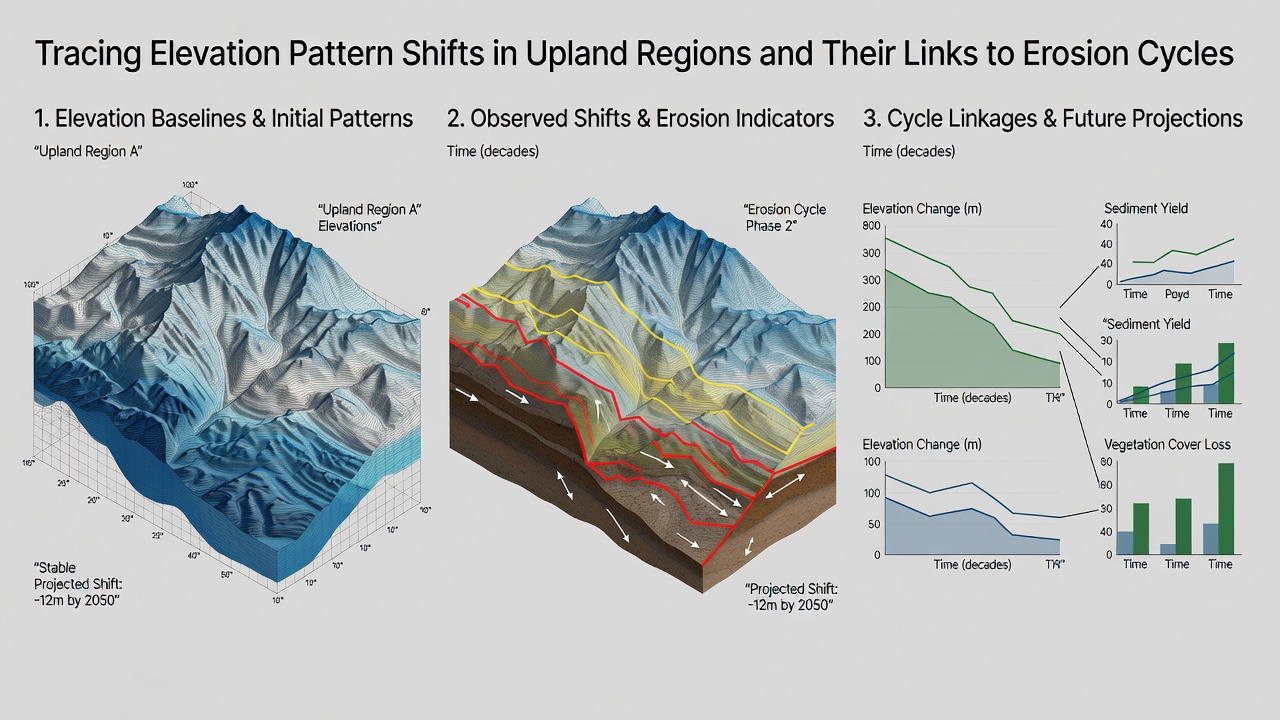
One study revealed that upland catchments with documented elevation losses of 2 to 5 millimeters per year also recorded higher suspended sediment loads during storm events, and this pattern held across sites in North America and Europe. When vegetation cover decreases due to drought or land use, the protective effect against raindrop impact diminishes, accelerating both elevation change and sediment movement. Observers note that the timing of peak erosion often aligns with periods when snowmelt or monsoon rains coincide with prior weathering, creating conditions where loose material moves downslope in concentrated pulses.
Regional Examples and Data Patterns
In the western United States, USGS monitoring shows elevation declines concentrated along fault scarps and incised valleys where erosion cycles have deepened channels over the past two decades. Australian researchers using Geoscience Australia datasets report similar trends on plateau margins where episodic heavy rains remove weathered material and lower overall surface heights. European Environment Agency reports document comparable elevation adjustments in alpine uplands, where glacier retreat exposes new surfaces to rapid erosion during the first years after ice loss. These geographically varied records indicate that the relationship between elevation shift magnitude and erosion cycle intensity remains consistent even when climate and rock types differ.
Longer time series help separate natural variability from directional change, and multi-year comparisons show that years with above-average precipitation produce larger elevation drops in a single season than drier intervals. When such events cluster, the cumulative effect alters drainage patterns and exposes previously protected layers to further weathering. Data indicate that sediment budgets calculated from elevation differences match independent measurements taken at stream gauges, confirming that the observed surface lowering translates into measurable material export.
Future Monitoring and Cycle Implications
Continued collection of elevation data through 2026 and beyond will refine models that predict how erosion cycles respond to changing climate parameters. Integration of these measurements with hydrological records allows calculation of sediment delivery ratios that link upland source areas to downstream deposition zones. When elevation patterns shift systematically downward in headwater regions, downstream channels often experience increased aggradation during the same period, illustrating the connected nature of the erosion cycle across the full landscape.
Conclusion
Elevation pattern shifts traced in upland regions provide direct indicators of active erosion cycles, and the combination of remote sensing with field validation produces reliable records of surface change. Regional datasets from multiple continents demonstrate consistent links between measured elevation loss and sediment transport volumes, while planned observations in September 2026 will extend these time series. The resulting information supports improved understanding of how weathering, detachment, and transport processes interact to reshape upland terrain over time.